


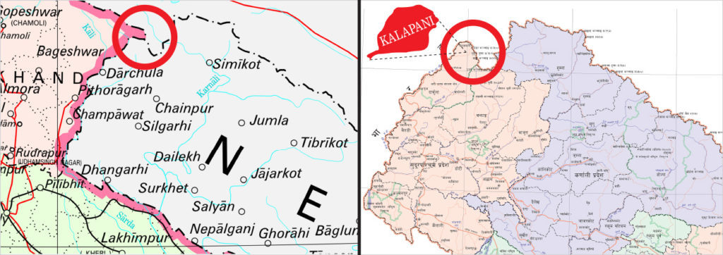
A new map created by Nepal shows parts of India included into the Nepal territory triggering border dispute with India. The map shows Lipulekh, Kalapani and Limpiyadhura under its territory.
The move announced by Foreign Minister Pradeep Kumar Gyawali came weeks after he said efforts were on to resolve the border issue with India through diplomatic initiatives. Nepal’s ruling Nepal Communist Party lawmakers have also tabled a special resolution in Parliament demanding return of Nepal’s territory in Kalapani, Limpiyadhura and Lipulekh.
The Lipulekh pass is a far western point near Kalapani, a disputed border area between Nepal and India. Both India and Nepal claim Kalapani as an integral part of their territory — India as part of Uttarakhand’s Pithoragarh district and Nepal as part of Dharchula district. Gyawali said the official map of Nepal will soon be made public.